
White Point Nature Preserve in San Pedro, CA is a remarkable gift of public open space nestled into 100 acres of bluff overlooking the Pacific Ocean. It’s a landscape that visibly bears the marks of tumultuous human endeavors spanning at least the last two centuries, including the concrete and *rusting defenses built to prevent military invasion. Walking its paths, the landscape provokes insistent questions impossible to ignore like: How in heck did all this prime coastal Southern Californian real estate with a front-seat view of Catalina Island escape developers’ interest to become set aside for hiking trails and rebuilding native plant and wildlife communities?

Not a few miles up the coast there are swanky resorts and a famously branded golf course, but here at WPNP it’s been granted permission to slowly find its way back to coastal bluff scrub. How did this happen? I’ll tell you what I know. My credentials? I’m an old Pedro girl myself (btw “Pedro” is pronounced by the locals with a long “e”), and my brothers and cousins regularly surfed Royal Palms just across the road from WPNP. And when Marty told me the story of the wreck of the Dominator off nearby Rocky Point, sailing us in as close as safety and the tides allowed to inspect its *rusting hulk, is probably when I knew I’d marry him. And I have a thing for disturbed places whose very existence poses thought-provoking questions about land use. (*And apparently I’m also drawn to stories with lots of rust.)

1978, by means of a quit claim deed from the Secretary of the Interior for ‘perpetual
use as and for public park and recreation purposes.'”
Master Plan for the White Point Nature Preserve
“The White Point site holds significant cultural resources mirroring California’s rich history. Juan Rodriguez Cabrillo first encountered the indigenous inhabitants, the
Gabrielinos, in 1542. Spanish colonization of the area began in 1769, and in 1827, the Sepulveda family was given White Point as part of the vast Rancho de Los Palos Verdes land grant. The Sepulvedas used the land for grazing cattle. In 1899, Japanese immigrants leased the land and established an abalone fishery, a beachfront resort and later, farmed the area. During WWII, White Point was taken by the Federal government and incorporated into the Coastal Defense system of Fort MacArthur.” — Master Plan for the White Point Nature Preserve, Pages 63-64

WPNP was included in the Theodore Payne Native Plant Garden Tour in 2018, a very exciting piece of news that I frustratingly couldn’t act on at the time since an AGO pop-up event was planned for the same day. But it seemed so fitting and gratifying to me that the site of this former military installation overlooking the Pacific Ocean was still furthering worthwhile, non-military, post-Cold War era pursuits, and I couldn’t wait to visit this latest worthy iteration involving native plants. Our young family had benefited immeasurably from this site when one of the former barracks was transformed into a Montessori preschool with a sleepy rural ambience that Mitch attended half days from 1986-88 when I worked from home.

San Pedro has its own rough, land’s end feel to it, and White Point pushes that to a Bronte-esque apotheosis. That it appeared to be semi-forgotten only added to its allure. Artists’ studios and a hostel also found a home here, but at the time it felt like we had the mostly deserted fort to ourselves — just us, some chickens and rabbits, about a dozen free-range preschoolers, and row after row of empty barracks. In my burnished memory, the rickety playground fence draped in passionflower vines seemed to be continually enveloped in clouds of butterflies.

“White Point is a highly disturbed parcel of land comprised of large open field areas with limited road access to several buildings, foundations and underground structures. All vegetation habitats have been exposed to varying degrees of anthropogenic disturbances. Prior to these man-made alterations to the area, the land was most likely composed of coastal sage scrub (CSS), coastal bluff scrub and native grassland plant communities. At present, the native habitat has been replaced almost completely by annual non-native grassland and disturbed ruderal vegetation with planted ornamental trees scattered throughout the site. Remnants of coastal sage scrub vegetation can be found on the site in the form of small patches of sage scrub shrubs and individual CSS plants. ” Master Plan for the White Point Nature Preserve

Even though we left San Pedro in 1989 (buying a house here was out of our price range), this particular area had been such a beloved feature of our daily lives that I didn’t even check for an address when I raced up to visit the nature preserve the first chance I got — and then couldn’t find it. After that mortifying experience of driving around and around a very familiar area and not being able to locate a large green building with red trim and clear signage, I didn’t try again for a year.

Last week I resolved to give it another go and, humbled, this time checked for an address: 1600 W Paseo Del Mar, San Pedro, CA 90731. In 2018 I had entered the “upper reservation” from Gaffey Street, just as I always did five days a week so many years ago. I later learned that recent landslides in 2011 stemming from an unknown source of groundwater cut off WPNP from that access. (Groundwater issues aside, this is a notorious geologically active area due to the Palos Verdes Fault. The road along the coast seems to have new hollows and twists every time we go, turning into an especially rollicking rollercoaster near Frank Lloyd Wright’s Wayfarers Chapel, and that newish golf course had some trouble with its greens falling down the cliffs into the ocean too.)

The Master Plan for the White Point Nature Preserve, published in August 2001, which I’m freely quoting from for this post, answered a lot of my questions. Because I know this area a bit, I had some theories as to its current status, but after we left San Pedro in 1989 I lost track of the chain of custody of the land. Roughly, it goes like this: Home to the Gabrielino Indians, grabbed by the Spanish who leased it to Japanese fisherman, who lost the lease when they were sent to WWII internment camps and the military took over the land, later deeded by the Secretary of the Interior to the City of Los Angeles in 1978, which stipulated the area “be used for coastal open space retention, habitat restoration, passive recreation and historical preservation” in 2000. Managed in partnership with the Palos Verdes Peninsula Land Conservancy, landscape restoration plantings commenced around 2001.

“The proposed project is also consistent with the Natural Community Conservation Program (NCCP). The NCCP was initiated by the California Department of Fish and Game in order to streamline and coordinate development and preservation of habitat, especially coastal sage scrub and related plant communities. The program is established by the Natural Conservation Planning Act of 1991 (Fish and Game Code Section 2800.) The intent of this program is to encourage cooperation among landowners and developers, conservationists and regulatory agencies to protect long-term viable populations of California’s native plants and animals in their natural habitats and in landscape units which are large enough to ensure their continued existence. The NCCP Planning Agreement identifies six target species for the Rancho Palos Verdes planning area: California gnatcatcher, cactus wren, San Diego horned lizard, Palos Verdes blue butterfly, El Segundo blue butterfly and a plant, the bright-green dudleya or live forever.”


Further out from the education center the remnants of former military operations become more prominent, and aging hardscape covers some of the ground.


daisy, mustards, giant reed and ice plant.”


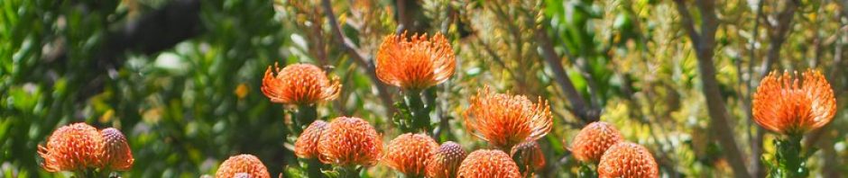
If you like roaming through “anthropogenically disturbed” landscapes that visibly spill their layers of historical secrets, a landscape interrupted but not beaten, White Point has your number too. Dogs on leash are welcome. A native vervain I discovered in bloom on my hike, Verbena lasiostachys, was available at their plant sale I happened to luck into, which is held the second Saturday of every month.
I’m embarrassed to admit that I’ve yet to visit the Preserve despite its relative proximity. I just checked the map and it’s a mere 4.4 miles (a 10 minute drive) away. It looks like a good place to escape to once renovation starts, assuming that ever happens. We’ve been delayed at least another 2 weeks – again.
I was right there with you when you set out for a place you knew, only to not be able to find it. Thanks for heading back, with address and camera. Looks like a great place to explore.
I love to watch how Nature recaptures a disturbed site. Takes you back to a different historical time. Thankfully someone had the foresight to protect this beautiful piece of property for all to enjoy.
I imagine developers didn’t get it because the area is so geologically unstable. It sure is beautiful. Enjoyed the story of your history of this land, MB’s excellent photo (and yours) and the rest of the history.
@Kris, so sorry about the delay! Yes, wide open spaces will help during this difficult time…
@Loree, I have to admit I doubted my sanity, memory, not uncommon these days!
@Elaine, I think this nature preserve is going to get better and better — so many people working on it the day I was there.
@Hoov, I thought of that too, but then there’s the case of that golf course getting permission to build in a very unstable area…